Oil field. The Republic of Komi.
Цена: 150000000.00 руб
For sale are the oil fields that have a license to use subsoil up to January 2025 (license number was granted by CЫК with the purpose - prospecting, exploration and extraction of hydrocarbon raw materials, by order of the Russian Ministry of Natural Resources and the agreement of the Government of the Republic of Komi).
The license number was granted by СЫК with the purpose - prospecting, exploration and extraction of hydrocarbon raw materials, by order of the Russian Ministry of Natural Resources and the agreement of the Government of the Republic of Komi, in the period up to January 2025.
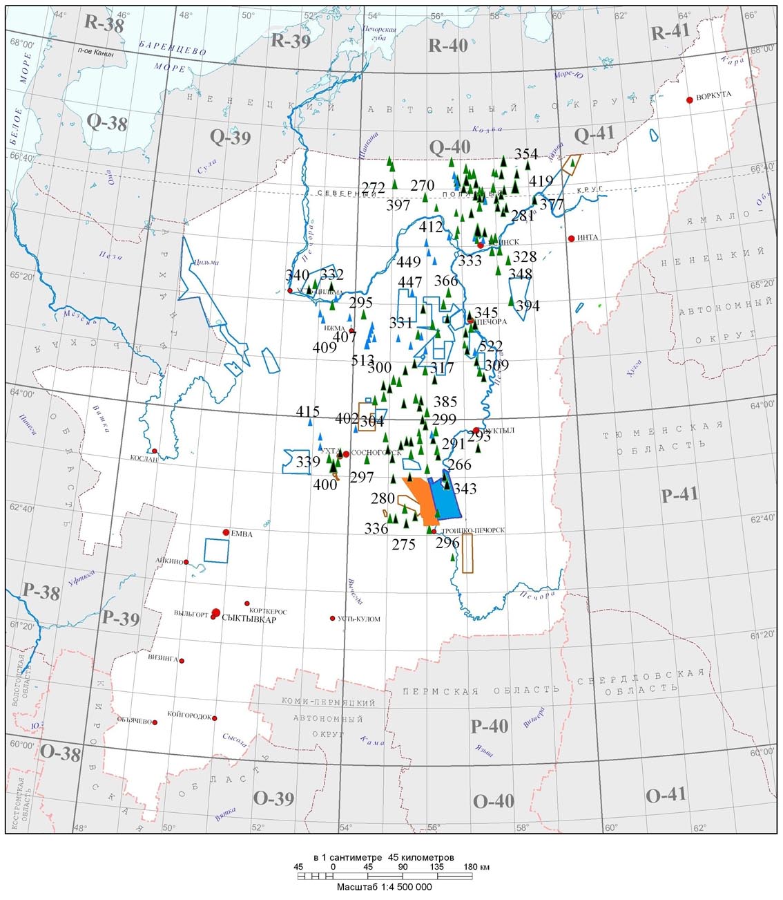
South Timan area of 1300 sq.km. located in the Troitsko-Peckorsk region of the Republic of Komi.
South Timan square is 1300.477 km2.
The subsurface was given the status of geological allotment with limited depth of 4,000 meters in elevation above sea level.
At the license area, by the results of geological exploration in 2004, were placed on the public balance recoverable reserves of oil re-open field
Rusanovskoye of a category C1 + C2, in the amount of 1.403 million tons
The objects of search, exploration and production within the license area are hydrocarbon deposits, deposits of Permo-Carboniferous, Middle and Upper Devonian.
There were made a geological exploration works.
In 2003, field seismic search CDP 2D works were performed in the amount of 505.7 running km. In late 2003 - early 2004 were made special processing of seismic data obtained for the detailed study of the geological structure, AVO - analysis using Paradigm Geophysical program.
The result was a complex set of sandstones spread most promising oil and gas of Dzherskogo and Yaransk floors of the Upper Devonian.
Plicative model was built by the geological structure of the South Timan area of monoclinal subsidence stratum in the eastern part. There were revealed a few low-amplitude structures, prospective deposits of hydrocarbon raw materials.
In 2004, the data of the field of seismic exploration in 2003 have been reprocessed and interpreted. The result was the construction of a new, tectonic model of the study area with the presence of zones of tectonic disturbances, which can control the tectonically screened and anticlinal traps of hydrocarbon feedstock.
In 2005 - 2006, with the aim of detail the identified structures as well as to study the geological structure of the previously studied areas within the floodplain and the left bank of the river Pechora CDP 2D seismic explorations were carried out using a non-explosive (vibrators and airguns) sources of vibrations.
Completed 750 running km of seismic profiles. According to their results, three structures have been prepared and placed on the State balance: East Grishalskaya, Grishalskaya and North Grishalskaya with the general recoverable oil resources of category C3 - 2.775 million tons.
At the license area were drilled three searching (№ 1, 2, 4 of the South Timan) and one exploratory well № 12 - Pokchinskaya. In the well № 2 of the South Timan, of sandstone D3 dzr age, was obtained oil flow with the output of 0.65 m3 per day. As a result of drilling this well the reserves
were calculated and Rusanovskoye oil field has been put on the State balance.
Geotechnical surveys have been carried out and a working project (WP) for the construction of exploratory well № 5 of the South Timan and Grishalskoy structures has been prepared.
WP has passed all the necessary expertise.
At the most promising areas geochemical studies were carried out by the method of "Gore Sorber" of 500 points. Thematic research study of the patterns of distribution reservoirs have been conducted.
Map of oil field locations.

|


 +7-495-925-66-01


 Главная
  Разведка месторождений ПГС
  Контакты
  Оставить отзыв
  Электронные каталоги